Cold front to drop temperatures 15-25 degrees by Thursday in Northern California
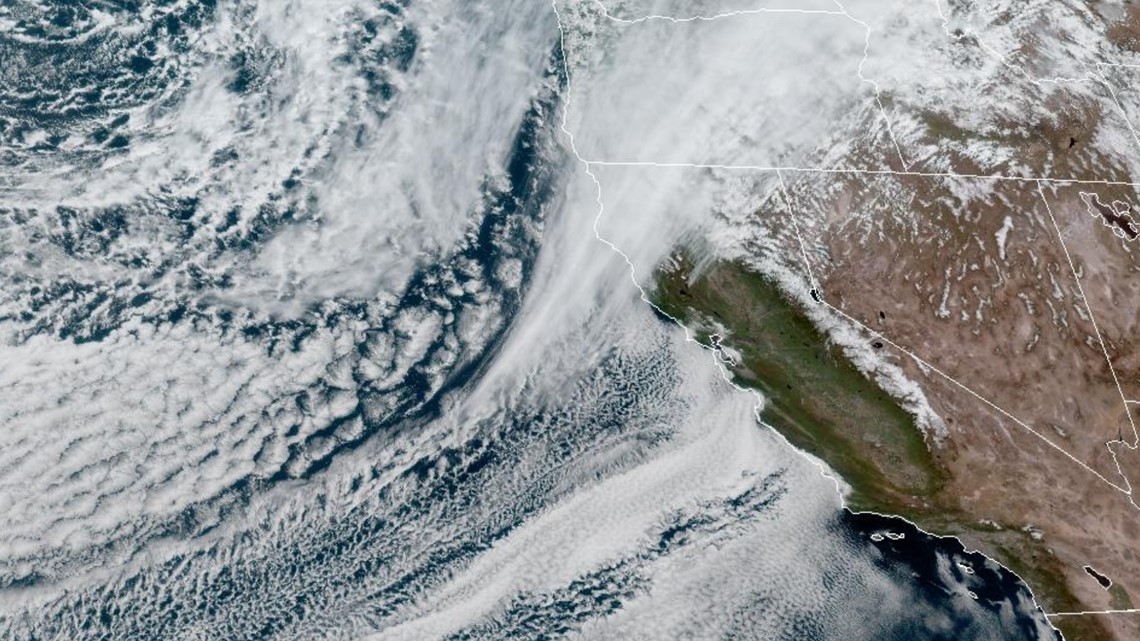
An unseasonably cold system dropping down from the Gulf of Alaska will drop temperatures well below average and bring more rain and snow to the region. An unseasonably cold system from the Gulf of Alaska is expected to drop temperatures below average and bring more rain and snow to Northern California. The system will send Northern California back into winter after a few 70 degree days to start the month. Temperatures reached the mid 70s on Tuesday and will hover around 70 on Wednesday afternoon. The cold front will push south on Wednesday night and will reach the Sacramento area early Thursday morning, with rain expected to fall on and off throughout the day. High temperatures will be 10-15 degrees below average on Thursday and Friday, with highs only in the mid to lower 50s in the valley, 40s in foothills, and 20s and 30s in Sierra. Rain totals are expected to be light due to the lack of moisture and the rain shadow effect from the Coastal Range. A Winter Weather Advisory is in effect for the Sierra.
Published : a month ago by Brody Adams in Weather
An unseasonably cold system dropping down from the Gulf of Alaska will drop temperatures well below average and bring more rain and snow to the region.
Example video title will go here for this video
Example video title will go here for this video
A cold, relatively moisture starved system will send Northern California back into winter following a few 70 degree days to start the month.
Temperatures reached the mid 70s on Tuesday and will hover around 70 on Wednesday afternoon as the cold front nears.
The cold front will push south on Wednesday night and showers are expected in the northern Sacramento Valley. The cold front will reach the Sacramento area early Thursday morning and rain will begin around 8 a.m., continuing on and off throughout the day.
High temperatures will be 10-15 degrees below average on Thursday and Friday with highs only in the mid to lower 50s in the valley, 40s in the foothills and 20s and 30s in the Sierra.
Rain totals will be light and only 0.10-0.25” is expected through Friday. The lack of moisture and the rain shadow effect from the Coastal Range will contribute to limiting totals.
In the Sierra, precipitation will begin Wednesday night and a Winter Weather Advisory is in effect from 11 p.m. Wednesday through 11 p.m. Friday.
Snow levels will begin around 6,000-7,000 feet before the passage of the cold front drops them to 2,000-3,000 feet. The low snow levels on Thursday night and into Friday morning means that flurries and light accumulations are possible in the foothills.
The heaviest snow will be south of Highway 50 with this event with 6-18" expected. To the north and along Interstate 80, 2-8" are expected. The snowpack is in great shape and the statewide snow water content, the amount of water contained within the snowpack once melted, is at 28.3” and 110% of average. On January 1, the statewide snowpack was only at 28% of average.
Temperatures will remain on the chilly side through this weekend before a warming trend pushes temperatures near 80 by the end of next work week.